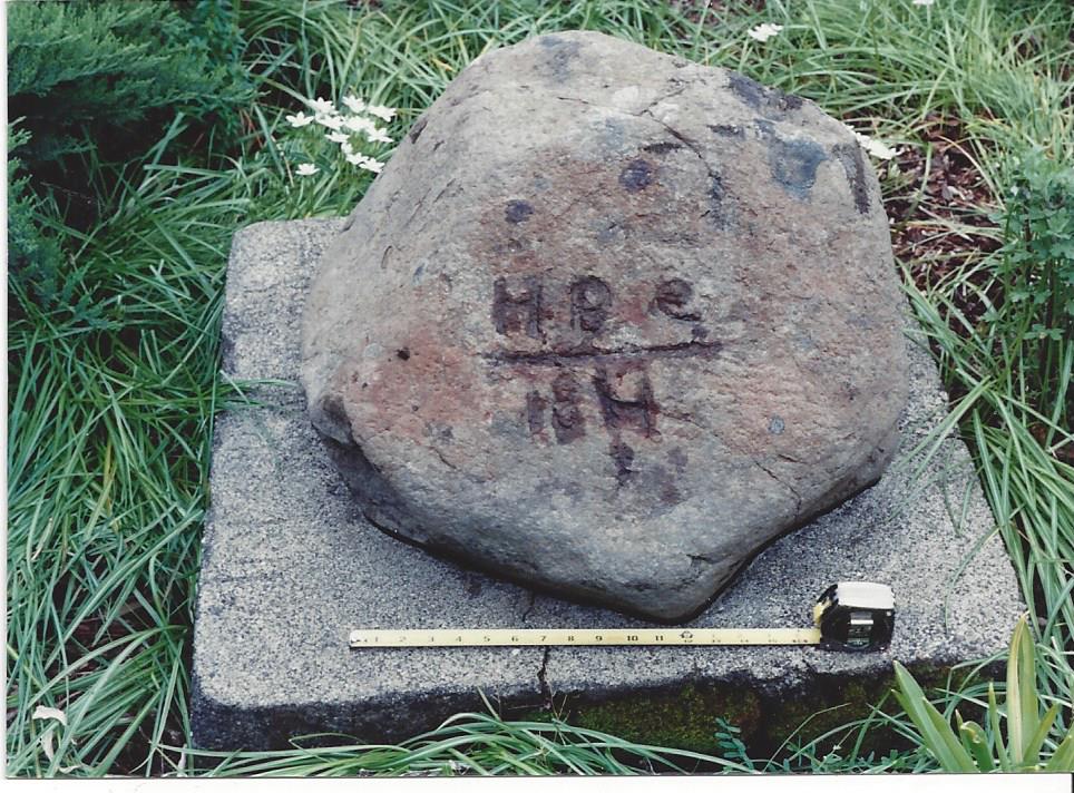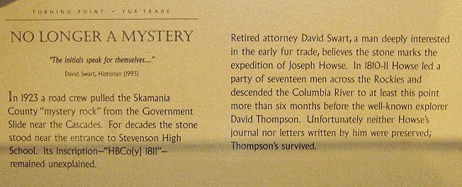
THE HUDSON'S BAY TRAIL MARKER
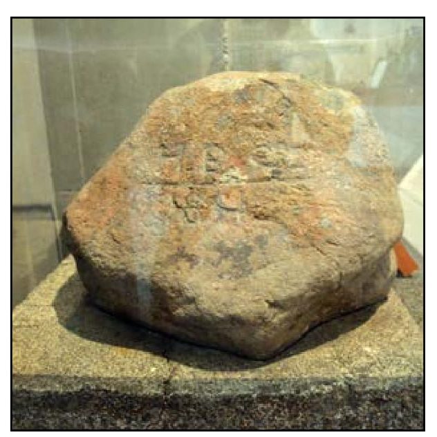
The Hudson's Bay Company sent it's first fur trading expedition into the Pacific Northwest in 1810-1811 to rival the North West Company under the leadership of one of it's officers, JOSEPH HOWSE, a novice explorer. His party was composed of 17 men, including four Cree hunters and guides. Although there is no record of the party reaching the Cascades on the Columbia River, this marker bears mute testimony of this fact. It was originally inscribed: "HBCoy" however, due to unintentional rough handling and the elements of time, only a portion of the lettering remains. This could have been the turning point of the expedition and / or indication of a desire to establish a trading post on the site of discovery, where it was unearthed just west of the Government Slide area by a highway construction crew in 1923. It was not properly identified until 1993.
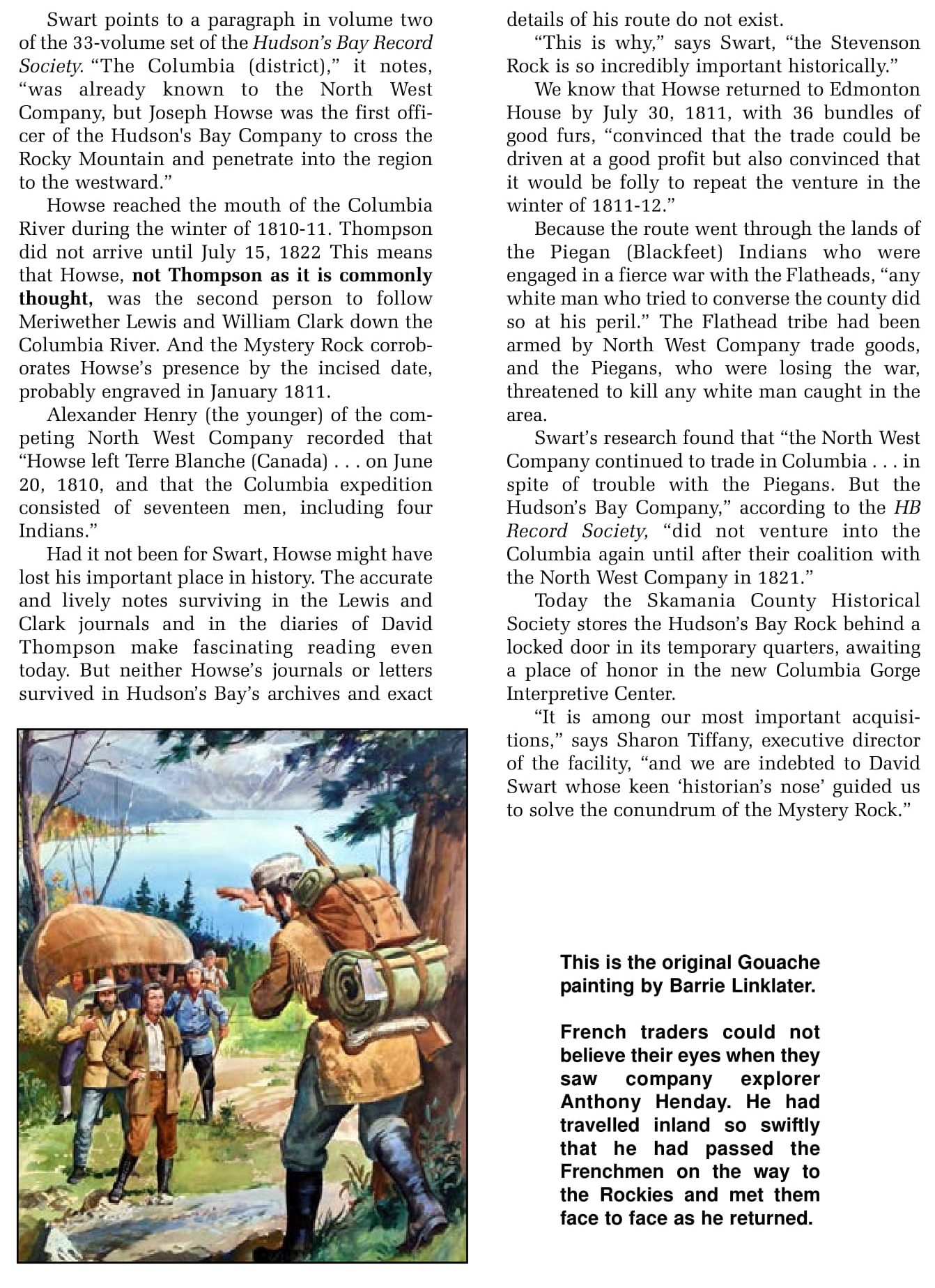
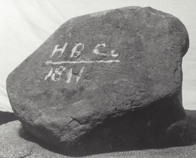
 In this photo white chalk was used to highlight markings on the Joseph Howse Mystery Rock
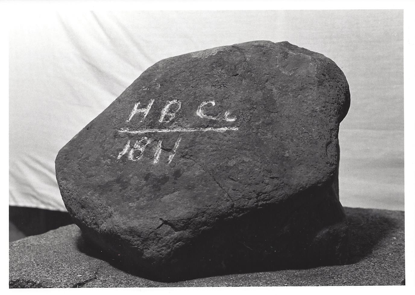
 David C. Swart (right) with fellow historian John T. Labbe (left)
In 1920 at Government Slide, which is four miles west of Stevenson, 200 feet of wood planking were laid by a state road crew at a cost of $916.57. This stretch of highway was known then as the North Bank Highway. In 1929 the name was changed to Evergreen Highway, and then again in 1955 to SR14.
From a May 8, 1921 article printed in the Oregon Journal regarding road conditions it was noted there is a twin plank road near Stevenson. They advise one traversing the twin lines of planking to be careful. Should your wheels slip on the slippery boards, and the vehicle fall off, it will be a challenge getting back on the path again.
The article warns there are bad road conditions from Skamania to Stevenson. The road surface alternately consists of clay, crushed rock, mud holes, planks, is narrow at times, and some of it has been washed out. Overall the road is fairly rough almost to the edge of Stevenson.
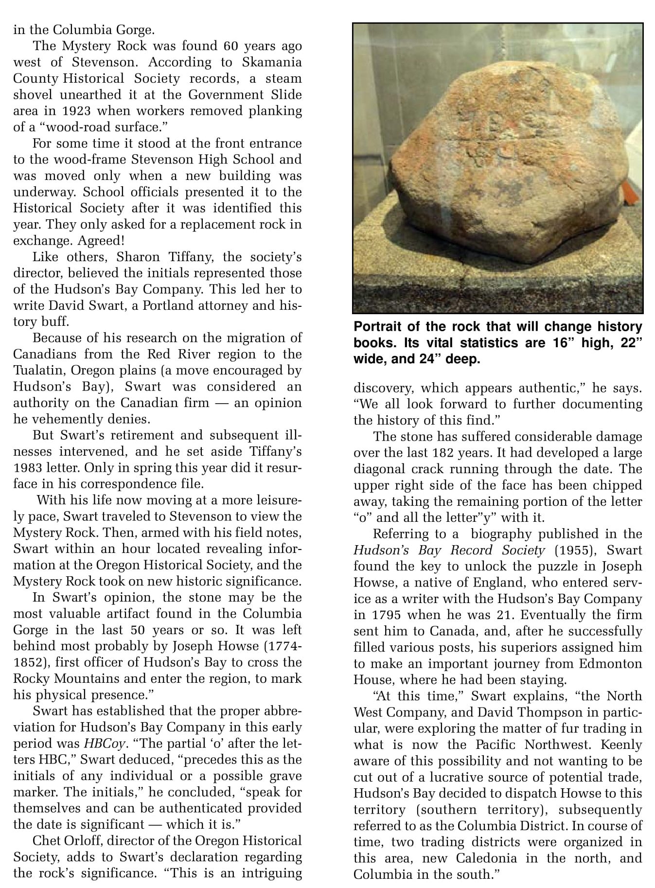
In 1923 the state began making improvements to the road around Government Slide. Albert W. Attwell shared his personal experiences regarding the Joseph Howse Mystery Rock find with Sharon Tiffany of the Columbia Gorge Interpretive Center Museum in December 1993. Albert's brother Walter G. Attwell had been a resident engineer for the State of Washington Highways at the time of discovery. Jack Wright had previously shared with the museum in 1973 or 1974 what he remembered about the find in 1923. That it had been dug up by a steam shovel while removing "wood" road planking from the road surface.
Walter Attwell suggested the rock be placed at the entrance of the old high school in Stevenson. The first Stevenson High School was brick facade over a wooden frame. In it's day was highly regarded by the community.
Albert Attwell remembers seeing the rock at the edge of the road before it was moved to the high school. The site was west of the Government Slide area. The road improvement around Government Slide was just part of the total highway project. The area around there was very unstable.
Albert said that the rock was found in a more stable area, where a camp site might have been located. The rock was located during the same contract period as they were removing the planking from Government Slide.
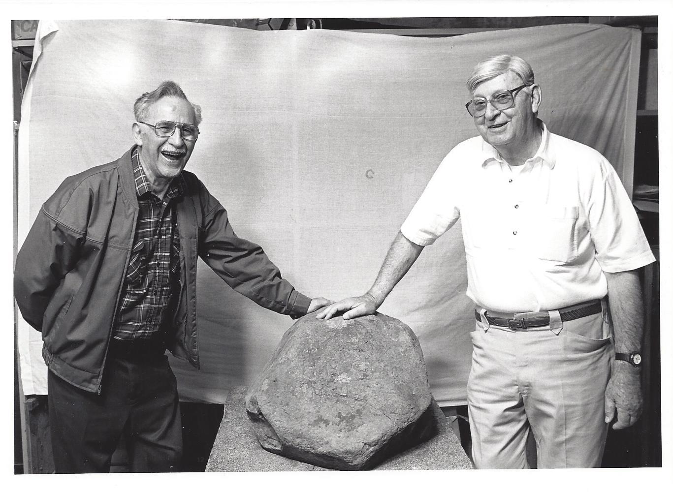
 Joseph Howse
(1774-1852)
( BC Archives collections photo )
The rock was believed to have been engraved in early January, 1811 on the Joseph Howse HBC Columbia expedition's return trip to a spot near Kalispell, Montana. A similar rock was found at the lower cascades, sent to Washington Historical Society, but believed now to have been misplaced or lost.
Joseph Howse is probably best remembered for Howse Peak, Howse Pass and Howse River, all located in Eastern British Columbia.
A portion of a Hudson's Bay biographic sketch on Joseph Howse reads as follows: "The Columbia was already know to the North West Company, but Joseph Howse was the first officer of the Hudson's Bay company to cross the Rocky Mountains and penetrate into the region to the westward. Alexander Henry (the younger) of the North West Company recorded that Howse left Terre Blanche, where Edmonton House was then situated, on June 21, 1810, and that the Columbia expedition consisted of seventeen men, including four Indians. Howse crossed the Mountains by way of the pass which now bears his name, although David Thompson had first used it in 1807. Neither Howse's journal nor letters written by him from the Columbia to James Bird have been preserved in the H.B.C archives, and Bird's remarks on and the reports of the expedition do not give exact details as to the route followed."
The North West Company continued to trade in the Columbia and in the autumn of 1811 McDonald's party in spite of trouble with the Piegans (Blackfeet), managed to cross by Howse Pass, but the Hudson's Bay Company did not venture into the Columbia again until after the coalition of 1821. The furs brought back by Howse had more than paid for his expedition. However the mountain route they had taken to the Columbia was considered too dangerous by Howse. This was due to ongoing hostilities between Flathead and Piegan tribes putting any white men caught in the middle at great peril. (Robertson's letters 1817-22, Hudson's Bay Record Society, appendix, pp2 221-223). This expedition was referred to as the Howse Columbia expedition of 1810-11.
There were four expeditions in the early 1800's that included explorations of the Columbia River. Each expedition was for the purpose of gaining information for it's sponsor.
Lewis & Clark (1805-06) was sponsored by the U.S. Government. Joseph Howse (early 1810-11) was sponsored by the Hudson's Bay Company (a corporation). John Jacob Astor (Early 1811) was sponsored by the Pacific Fir Company (a partnership). David Thompson (late 1810-11) was sponsored by the North West Company (a partnership)
The personnel of the Hudson's Bay Company were predominately English and Scotch. The North West Company were made up of French Canadians. The Pacific Fir Company consisted of Americans.
There was some cross employment worth nothing. John McLaughlin became an employee of the Hudson's Bay Company after 18 years of employment with North West Company. David Thompson went to work for North West Company after 13 years with Hudson's Bay Company.
Pacific Fir Company was sold to the North West Company in 1813 due to war with Great Britain. North West Company seeing greater power from Parliament was ultimately required to merge with Hudson's Bay Company in 1821. Hudson's Bay Company first entered Columbia District after coalition in 1824.
John McLoughlin, Chief Factor, Columbia District, reined from 1824 to 1846 and became known as the "Father of Oregon". At which point he took a three years leave of absence and retired in Oregon City on June 1, 1849.
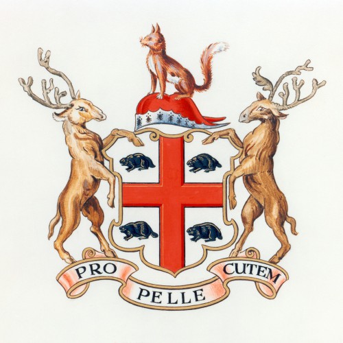 Hudson's Bay Coat of Arms
Trail markers were commonly used in the 1800's. The rock below was found about 20 miles from the route taken through NE Oregon by the Overland Expedition in 1811-1812. This location was approximately 30 miles NE of John Day, Oregon.
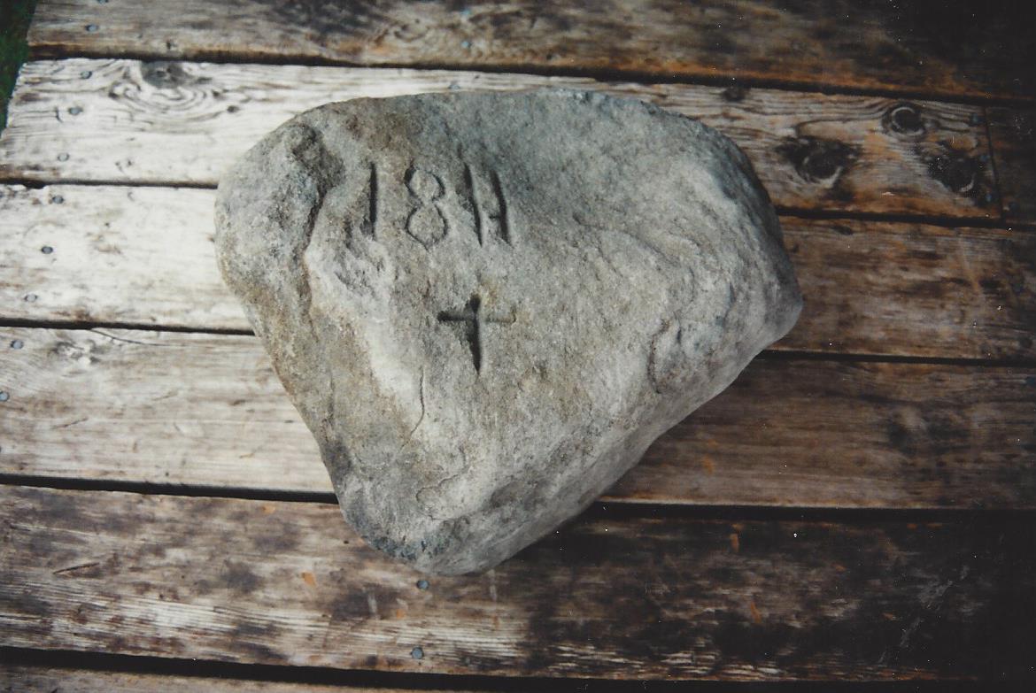 Michael McKenzie photograph - 1995
Rock below was left by explorers from the Astor Party in 1813. It was found on the banks of the Deschutes River. Photograph below was taken at the Deschutes City Museum in Bend, Oregon.
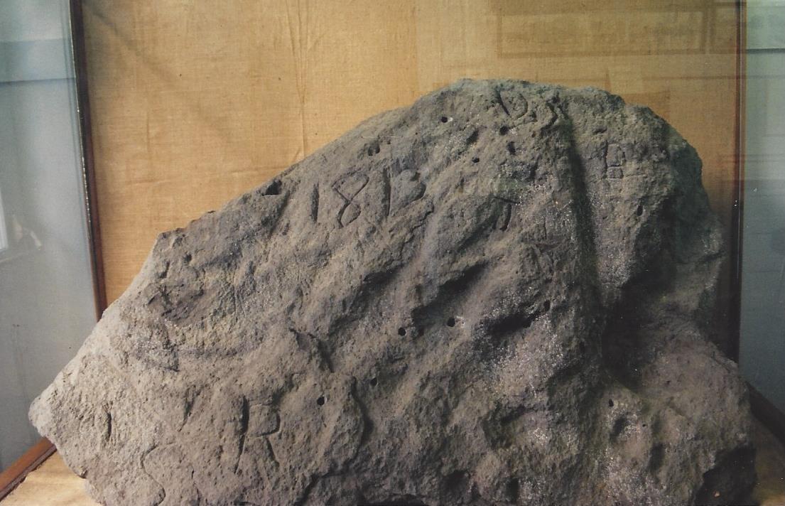 Michael McKenzie photograph - 1995
Photo below taken in 1992 shows the difficulty of being able to read the Joseph Howse Mystery Rock markings clearly. For this photograph charcoal was used to highlight the inscription.